
FUI terrain [work in progress].
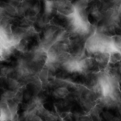
I was trying to find a way to make a procedural, instead of an image or DEM based elevation map that I could contour for this FUI test. I ended-up using a modified fractal noise layer (see below) which gave me a nice looking luminance based elevation model, which I used to drive Trapcode Form to give me a base particle layer, where the particle position (& size) in Y is based on the luminance of the Fractal noise layer.
I generated the contours by using the same fractal noise layer but adding a Threshold and Find edges, then Invert & UnMult. I duplicated the layer & moved it up in Y and gave the Threshold a higher level & repeated until I had my contour stack.
Making it this way allows you animate the fractal noise layer; so everything up the stack animates with it, including the base Form layer.
The grids were build with Trapcode Form as well.